
All articlesPublic-private partnerships
Fire Station Site Selection and Planning: A Practical Guide
A fire station is more than a building. Its location affects response routes, daily operations, public budgets, and nearby neighborhoods. That makes site selection a shared public decision, not simply a real estate searc...

Managing Director
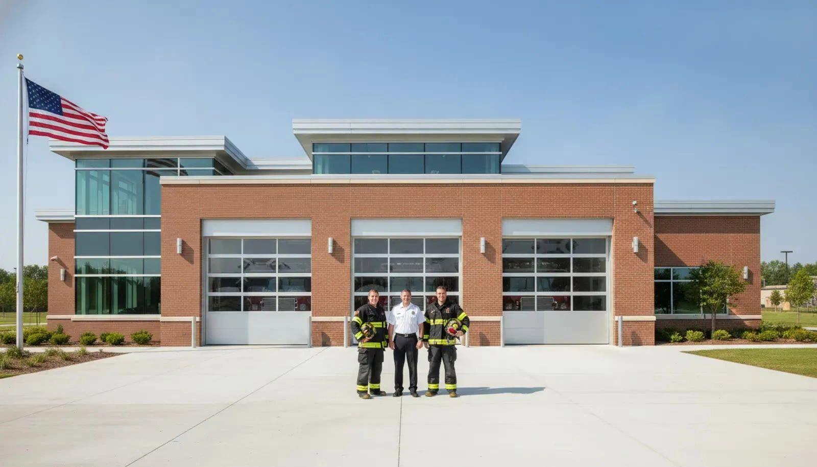
A fire station is more than a building. Its location affects response routes, daily operations, public budgets, and nearby neighborhoods. That makes site selection a shared public decision, not simply a real estate search. Fire station site selection and planning works best when fire personnel, planners, public works teams, elected officials, and residents contribute early. Their knowledge can reveal road barriers, development plans, utility concerns, or community priorities that a map may miss. In this guide, you’ll find practical steps for setting evaluation criteria, testing location scenarios, reviewing site constraints, and communicating trade-offs clearly. You’ll also learn how site decisions connect to project delivery and long-term public asset planning.
Key Takeaways
- Define the service the station must provide: Set coverage goals and response-time targets, then connect them to department operations and community needs.
- Assess candidate sites from several angles: Combine GIS and travel-time analysis with site visits, local expertise, and input from residents.
- Plan for long-term value and delivery: Compare facility requirements, lifecycle costs, resilience, future growth, and whether a public-private partnership supports the project’s goals.
Six checks to finish before a city names a preferred parcel. Local data sets the weight of each one.
- Set the service the station must provide.
- Map demand, hazards, and expected growth.
- Model road travel time, not straight-line distance.
- Test access, utilities, soils, flood risk, and zoning.
- Compare full cost, including operations.
- Apply the same criteria in public and write down the trade-offs.
Define Fire Station Service and Facility Needs
Before comparing sites, define what the fire station needs to accomplish. Clear service goals help officials assess locations and plan a facility that supports department operations, long-term public plans, and community priorities.
Set coverage goals, response-time targets, and service priorities
Start by agreeing on the level of service the department aims to provide. Set coverage goals and response-time targets, then identify priority areas such as dense neighborhoods, major roads, schools, hospitals, or industrial sites. These priorities will help guide site comparisons. Targets should reflect local conditions, department resources, and the community’s service expectations.
Use incident and travel-time data to test those goals. Sherer Architecture’s fire station planning guide shows how that data can point to a useful location. Write down the assumptions so others can see why a priority area made the list.
Review stations, call volume, staffing, apparatus, and mutual aid
Build a clear picture of current department operations before deciding what a new or relocated station should provide. Review station locations, call volume by area, response patterns, staffing, apparatus, and mutual-aid agreements. Look for workload differences between stations, coverage gaps, and areas where crews may be called away to assist neighboring jurisdictions.
The American Planning Association’s guidance on fire house location planning uses incident and workload records for this step. Ask leaders to explain odd trends, planned changes, and mutual-aid duties the file does not show.
Match facility needs to operations, public plans, and community priorities
Translate service goals into a practical facility program. Consider the number and type of apparatus, crew spaces, training and storage needs, site circulation, and room for future expansion. Requirements should reflect how the department operates and the services the station is expected to support.
A meeting room or public-education space can fit when it does not slow a response. McMillan Pazdan Smith’s fire station planning guidance covers that civic role. Tie the program to the capital plan early. Civic Six Partners helps public agencies plan and deliver civic facilities.
How Do Community Risk, Demographics, and Growth Shape Coverage?
Distance is only part of coverage. Population, housing, hazards, and future development change where calls happen and how fast a crew can get there.
Coverage overlays help a department see gaps that a station list does not show.
Map incidents, response times, population, and high-risk locations
Map where calls happen and how long responses take. Compare incidents with population, roads, land use, and higher-risk places such as plants, dense housing, schools, and care facilities. Count turnout and travel, not just distance.
GIS mapping for fire departments can show patterns a call log hides, including weather and building risk. Check the data before using the map to rank sites.
Consider age, mobility, housing, and other factors that affect demand
Age, mobility, and housing type change both the calls and the trip. Older adults may need different service than a new subdivision or a cluster of apartments.
Look at where people live, work, and gather, including schools and care facilities. This guide to fire station design compares candidate sites against those needs instead of a single population total.
Account for simultaneous calls, terrain, traffic, climate, and other barriers
A site can look close and still be slow to reach. Hills, rivers, rail lines, freeways, congestion, and flood-prone roads add time. A second call can pull the only crew away.
Sample figures only. A barrier can double the road trip, and drive time is only part of the response.
Straight-line distance
Sample figure: 1.2 miles
What it leaves out: Rivers, rail lines, and the streets crews actually drive.
Road distance
Sample figure: 2.4 miles
What it leaves out: Speed, congestion, signals, and a blocked crossing.
Call handling
Sample figure: 1 minute
What it leaves out: A busy dispatch center can take longer.
Crew turnout
Sample figure: 1 minute
What it leaves out: Night calls and gear checks can add time.
Drive time
Sample figure: 5 minutes
What it leaves out: Not the full response. Add handling and turnout.
Example total
Sample figure: 7 minutes
What it leaves out: A local illustration, not a response-time standard.
These rows use one made-up neighborhood so the difference is easy to see. Replace every number with the department’s incident records, a road-network model, and a timed drive before anyone scores a parcel.
Use actual travel times, not just straight-line distance, and check routes at different times and during different seasons. The American Society of Planning Officials’ report on fire house location planning recommends timing real and trial trips while considering local obstacles. Field checks can help confirm whether modeled routes reflect everyday conditions, including traffic, road closures, and access restrictions.
Identify underserved areas and planned development, annexation, and demographic shifts
Coverage needs can change as a community grows, changes its boundaries, or adds housing and public facilities. Map planned development, proposed annexations, and demographic trends alongside current response patterns. This can help officials identify areas that are underserved today and places where demand may increase over the life of a new station.
A site aimed at today’s busiest calls may miss the neighborhood that is about to grow. Put annexation, new housing, and neighboring-station workload in the same view as current incidents.
Use GIS and Technology to Model Coverage
GIS lets a department compare station locations on one map. Incident history, streets, people, hazards, land use, and planned growth can show gaps and how coverage shifts. Esri’s overview of GIS for fire departments describes how those maps support a shared decision.
Agree on the question first. Is the goal a faster trip to a high-risk area, better coverage when two calls come at once, or room for growth? That choice decides which data matters.
Combine incident, demographic, road, hazard, land-use, and growth data
Build one dataset for today and for the next decade. Include incidents, response times, population, roads, traffic, hazards, land use, and planned development. Add schools, care facilities, or industrial sites when those places drive local risk.
Use the same dates and boundaries in every layer, and write down gaps such as missing incidents or an old population estimate. A precise-looking map can still rest on weak data. Note where each layer came from and when it was last updated.
Use ArcGIS Pro Location-Allocation and Network Analyst to compare sites and travel times
ArcGIS Pro’s Location-Allocation tool assigns demand to candidate sites across the street network. Demand can be population, structure value, or street mileage. The ArcGIS fire protection case study shows the method.
Network Analyst estimates travel time on real streets. Use local speeds, and mark bridges, rail crossings, and limited-access roads. Drive time is not total response time. Call handling and turnout still have to be added. Keep the same assumptions for every site.
Use QGIS and other GIS platforms to map, analyze, and test scenarios
ArcGIS Pro is one option for this work. QGIS, an open-source GIS platform, and other systems can also help agencies map service areas, examine incident patterns, and compare possible locations. The QGIS documentation provides guidance on using the platform’s mapping and analysis tools.
Test more than one future. Compare sites under today’s calls and under expected growth, and again if one station is unavailable. Explain the method so staff and residents can see what the map leaves out.
Validate data, assumptions, and results with local knowledge and field checks
Ask firefighters, dispatchers, public works staff, and planners to review the maps. They know which road floods, which gate blocks a rig, and which development is missing from the file.
Visit the routes. Check sightlines, turning room, and whether emergency vehicles can actually use the roads in the model. Compare modeled times with past responses, write down every correction, and keep open questions visible.
What Makes a Site Operationally and Physically Suitable?
A site that appears ideal on a map may present challenges once emergency operations, construction needs, and community priorities are considered. Evaluate every candidate using consistent criteria, and involve fire personnel, planners, facilities staff, and technical experts early. This helps identify constraints before they affect project cost, schedule, or service.
Apparatus size and turning room belong in every site comparison.
A site visit shows whether apparatus can actually leave the parcel and reach the road.
Assess road connections, emergency access, traffic, and safe apparatus egress
A fire station needs reliable access to major roads and safe, direct routes into the areas it serves. Review intersections, turning movements, traffic patterns, and barriers such as rail lines or waterways. At the station itself, check that apparatus can exit quickly, with clear sightlines and enough space to turn without conflicting with other vehicles or pedestrians. More than one viable exit route can help crews respond when a road is blocked.
Visit candidate sites at different times of day, and ask transportation staff about planned road changes. Compare field observations with coverage goals and response patterns. The American Planning Association’s report on fire-house location planning identifies road access, safe exits, coverage, and effects on nearby residents as factors to consider.
Crew space and a direct path to the bay have to fit the parcel too.
Check parcel size, station layout, circulation, and expansion space
Start with the department’s operational needs, not a parcel’s advertised acreage. Define the number and types of apparatus, bay dimensions, parking, storage, training areas, and spaces for equipment cleaning or decontamination. Then determine whether the site can fit the building, required setbacks, stormwater features, outdoor work areas, and safe vehicle circulation.
Plan routes so responding apparatus can leave without crossing paths with public vehicles or pedestrians. Consider whether the parcel can accommodate future bays or support spaces if the department’s needs change. A programming study guided by fire-station design experience can help define the building’s size and layout before officials commit to a property.
Evaluate utilities, drainage, grading, soils, flood exposure, and environmental constraints
Confirm that water, sewer, power, and communications can serve the station at the capacity it requires. Ask utility providers about connection points, upgrades, costs, and schedules. Extending services or relocating existing lines can add significant expense, so investigate these needs during early due diligence.
Assess grading, drainage, soil conditions, flood exposure, and potential environmental concerns. A geotechnical study can identify soil or groundwater conditions that may affect foundations. Review flood maps and stormwater requirements, and check whether past land uses could require environmental testing or cleanup. The Firehouse site-selection guidance recommends confirming utility connection costs and challenges before purchasing land.
Confirm zoning, permits, ownership, and land acquisition needs
Check whether zoning permits a fire station and whether local rules could limit building height, size, setbacks, lighting, noise, or access. Review nearby land uses as well, since surrounding development can affect station operations and community concerns. Ask planning staff which permits and environmental reviews apply, and build realistic approval timelines into the project plan.
Read the title for easements and access limits. If the city must buy the parcel, know the process, schedule, and cost before calling it preferred. Civic Six Partners’ public-private partnership services connect that site work to how a civic facility gets delivered.
Compare Costs, Constraints, and Long-Term Resilience
A site’s purchase price is only one part of its cost. Utility extensions, site preparation, ongoing maintenance, and the ability to keep the station operating during emergencies all affect its long-term value. Compare candidate sites using consistent assumptions, and consider how each option supports both current operations and future community needs.
Estimate land, infrastructure, construction, operating, and lifecycle costs
Develop a full-life cost estimate for every site. Include land acquisition, design, site preparation, road access, utility connections, drainage, permitting, construction, equipment, and financing. Then estimate recurring expenses, including staffing, utilities, maintenance, and eventual repairs or replacement of building systems.
A cheaper build can still cost more to staff and maintain. The American Society of Planning Officials’ report on fire station location planning puts those ongoing costs next to construction. Use the same assumptions for every site.
Weigh site advantages against remediation needs and delivery risks
A well-located parcel may support faster response, but site conditions can affect its cost and schedule. Review ownership and land records for easements and other restrictions. Assess soil, drainage, environmental conditions, demolition needs, access, and the availability of water, power, and sewer connections. Identify permitting requirements and any work needed to prepare the property for construction.
Review donated land the same way. Firehouse’s site-selection guidance notes that a low price does not mean a low development cost. Write down cleanup, infrastructure, and schedule risk for each parcel.
Plan for hazards, continuity, adaptable facilities, and future growth
Consider how each site would perform during local hazards, such as flooding, severe storms, wildfire, or extreme heat. Check whether emergency vehicles can reach the station during disruptions, and plan for backup power, communications, water, and secure equipment storage where needed. The facility’s resilience should reflect its role in the wider emergency response system.
Fire station design guidance says to test projected growth before choosing a site. Match that view to the capital plan and to public asset delivery.
How Should Officials Compare Sites in Fire Station Site Selection and Planning?
A clear comparison process helps officials explain why a site best supports emergency response and community needs. Set the criteria before evaluating parcels, then apply them consistently and keep a record of the evidence, assumptions, and trade-offs behind the decision.
Response coverage.
What to measure: Road travel time, call volume, and gaps when two calls come at once.
Why it changes the decision: A close-looking parcel can still leave a high-risk area poorly served.
Access and apparatus.
What to measure: Road links, sightlines, turning room, and a second usable exit.
Why it changes the decision: Slow egress or one blocked route can erase a coverage gain.
Parcel fit.
What to measure: Bays, crew space, parking, setbacks, and room to expand.
Why it changes the decision: A tight site forces a redesign or a smaller station.
Site conditions.
What to measure: Utilities, grading, soils, drainage, flood risk, and cleanup needs.
Why it changes the decision: Hookup and cleanup costs can outweigh a low land price.
Acquisition and approvals.
What to measure: Ownership, zoning, permits, easements, and a realistic schedule.
Why it changes the decision: A site that is hard to buy or permit is not a real option yet.
Lifecycle cost.
What to measure: Build, operate, and maintain costs, plus hazard and growth cases.
Why it changes the decision: A cheaper build is not always the lower-cost public asset.
Apply consistent criteria and document how you weigh trade-offs
Agree on evaluation criteria before scoring candidate sites. These may include travel times to priority areas, road access, parcel size, utility availability, environmental constraints, acquisition and construction costs, and space for future expansion. Define how each factor will be measured so every parcel receives the same assessment.
Write down the weight of each criterion and the trade-off officials will accept. A well-connected parcel may still need costly drainage. A cheaper parcel may leave a high-risk area farther away.
Combine GIS scenarios with site visits, historical performance, and established planning practices
GIS can help compare how candidate locations may affect service across the community, but its results need to be checked against local conditions. Review mapped coverage alongside incident locations, historical response performance, and input from fire personnel who know the routes and operating challenges.
Walk each parcel. Sightlines, congestion, and road condition often fail to show up in the file. The American Planning Association’s firehouse location report warns against using a distance rule that ignores local conditions.
Test different demand, growth, and response-time assumptions
A site that meets current needs may perform differently as the community changes. Compare scenarios that account for population growth, planned housing or commercial development, shifts in call volume, and different response-time targets. Consider simultaneous calls, too, since a station’s availability can change when crews are already responding to an incident.
ArcGIS Location-Allocation can compare sites on street travel time. Record the forecast and the travel assumptions, then see whether the preferred site still holds under more than one future.
Avoid relying on straight-line distance or a single coverage metric
A circle drawn around a proposed station can suggest that nearby areas are well served. Straight-line distance does not show how crews will reach them. Rivers, rail lines, limited crossings, steep grades, traffic, and road design can all affect travel. Use drive-time or network analysis, and check important routes with local responders and site visits.
Also compare call volume, risk, population served, and help from neighboring stations. One good number should not hide a gap somewhere else.
Engage the Community and Coordinate Public Planning
A fire station affects emergency response, public budgets, nearby streets, and the character of its surroundings. Involving the right people early helps public agencies understand local needs, test site options, and explain how decisions are made.
Residents often know the congestion, school traffic, and flood-prone roads a model misses.
Involve fire services, public works, planners, elected officials, and residents early
Bring key stakeholders into the process before the team narrows its list of candidate sites. Fire and emergency services staff can describe response needs, apparatus requirements, and daily operations. Public works teams can flag road, utility, and drainage concerns, while planners can identify zoning rules and upcoming development. Elected officials and residents can share community priorities and knowledge of local conditions.
Early conversations surface conflicts while other parcels are still available. An inclusive fire station planning process also builds a record the public can follow.
Use meetings, workshops, surveys, and field input to identify local concerns
Offer several ways for people to participate. Public meetings can introduce the project and answer questions. Workshops can help residents and agency staff compare site scenarios, and surveys can gather input from people who cannot attend in person. Site visits and field walks can surface practical concerns, such as difficult turns, school traffic, or areas that feel underserved.
Ask where congestion slows travel, which routes are hard for apparatus, and where new homes or jobs will add calls. SEH’s fire station design guidance also covers how to explain the need for a station.
Explain selection criteria and trade-offs, and show how feedback shapes decisions
Share the criteria the team will use to compare sites, such as response coverage, road access, parcel conditions, cost, and future growth. Explain how each factor is assessed and where trade-offs may arise. One site may offer strong road connections but require costly utility work; another may serve a growing area but have environmental constraints.
If comments change a score or trigger a new study, say what changed and why. A reachability map can help people see how a parcel relates to their neighborhood.
Share decisions and next steps throughout planning
Keep updates coming at each major milestone. Tell the community what the team heard, which sites remain under review, what questions still need answers, and when the next update is expected. When officials identify a preferred site, explain how it performed against the stated criteria and outline the remaining studies, approvals, and funding decisions.
Post the update where people already look: a project page, email, a public notice, or a meeting. Correct mistakes quickly, and keep a record of what the public changed.
Connect Site Selection to Public Asset Delivery
A fire station site is one part of a larger public asset decision. Its location affects facility design, project costs, delivery responsibilities, and long-term service. Connecting site analysis to those choices early helps local officials compare options based on community priorities and the full project lifecycle.
Coordinate site planning with facility programming, budgets, and capital plans
Start by defining what the station needs to do. Consider staffing, apparatus, response access, work and living areas, circulation, and possible expansion. Then assess whether each candidate site can support those requirements within the project’s budget and schedule.
Put road upgrades, drainage, and utility extensions in the same comparison as land and construction. A data-informed site review keeps those costs next to the service the parcel would provide.
Align public priorities, financing, responsibilities, and risk allocation in a public-private partnership
If the community is considering a public-private partnership, connect the site decision to the project’s goals and delivery plan. Identify public priorities first, such as response coverage, facility performance, schedule, operating needs, and community access. Then clarify how financing, design, construction, maintenance, and key decisions may be shared between public and private partners.
Unclear title, cleanup, or a long utility extension changes cost and who carries the risk. Name those duties before a delivery model is chosen. Civic Six Partners’ public-private partnership services help agencies connect that site work to civic-facility delivery. A station can also include public space when operations still come first, as community-oriented fire station design describes.
Compare partnership options with other delivery approaches
A public-private partnership is one possible delivery approach, not the right fit for every project. Compare it with other options using consistent assumptions about project scope, cost, schedule, financing, and long-term responsibilities. The best choice depends on the community’s goals, internal capacity, project complexity, and appetite for different kinds of risk.
A parcel that needs a new road or a utility extension will not cost the same under every delivery method. Use the site facts in that comparison. GIS applications in fire station planning can test the location, but they do not pick the contract.
Reassess coverage and facility needs as the community changes
A site should serve the community not only as it exists today, but as it grows and changes. New development, shifting population, annexation, and changes to road connections can affect call patterns and emergency access. Review coverage assumptions regularly, using updated incident, demographic, road, and land-use information where available.
Revisit the assumption before the city commits to a long-lived building. Fire station planning guidance recommends checking locations again as roads and neighborhoods change.
Talk through a fire station site with Civic Six
Site choice is a public decision about coverage, cost, and how the station gets built. If your city is comparing parcels or weighing a public-private partnership, Civic Six Partners can walk through the project with you. Use the contact form or call 888-222-1882 to start a feasibility conversation. That call does not reserve a site, set a price, or guarantee a delivery method.
Frequently Asked Questions
What should officials decide before comparing fire station sites?
Start by defining the service the station needs to support. Set coverage goals, identify priority areas, and document operational requirements such as staffing, apparatus, and space for training or storage. Clear criteria make it easier to compare locations fairly.
How can officials tell whether a proposed site will improve response times?
Use road-based travel-time analysis rather than measuring distance in a straight line. Include turnout and call-processing time when assessing total response time, and check modeled routes against department records and on-site observations.
What information is useful for a fire station location study?
Useful information includes incident locations, call volume, response times, road and traffic conditions, population patterns, hazards, land use, and planned development. Check when the data was collected and note any gaps that could affect the results.
What should a site evaluation include beyond response coverage?
Assess access for emergency vehicles, parcel size, utilities, drainage, soil conditions, environmental concerns, zoning, acquisition costs, and room for future needs. Estimate ongoing operating and maintenance costs as well as construction expenses.
When should a public agency consider a public-private partnership for a fire station?
Consider a partnership when it aligns with the project’s public goals, available staff capacity, financing needs, and preferred allocation of responsibilities and risks. Compare it with other delivery options using consistent cost, schedule, and lifecycle assumptions. Civic Six Partners can help public agencies plan and deliver civic facilities through partnership models.